

CHCNAV RS7 Handheld LiDAR SLAM Scanner with RTK

$9,945.00

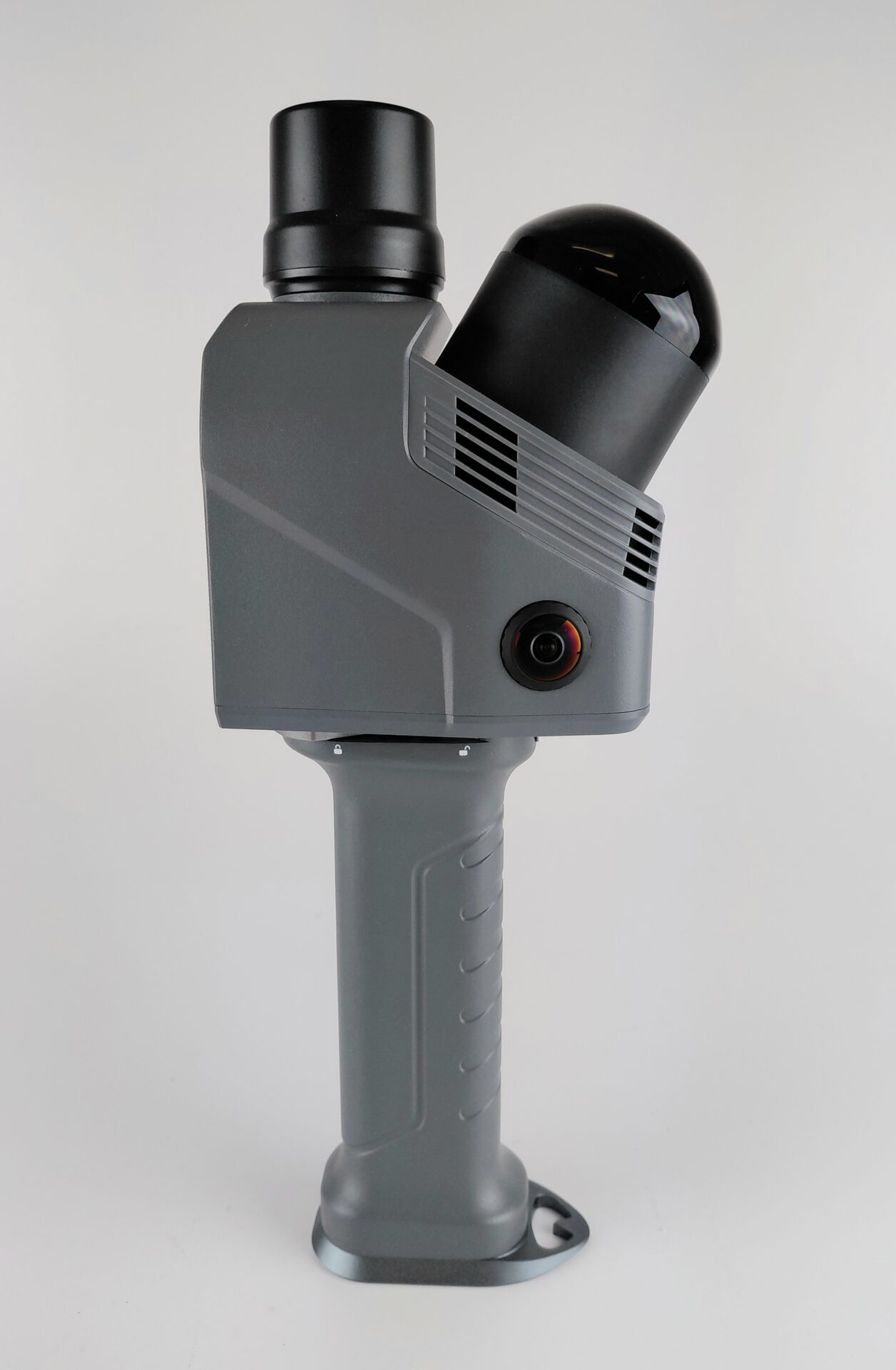
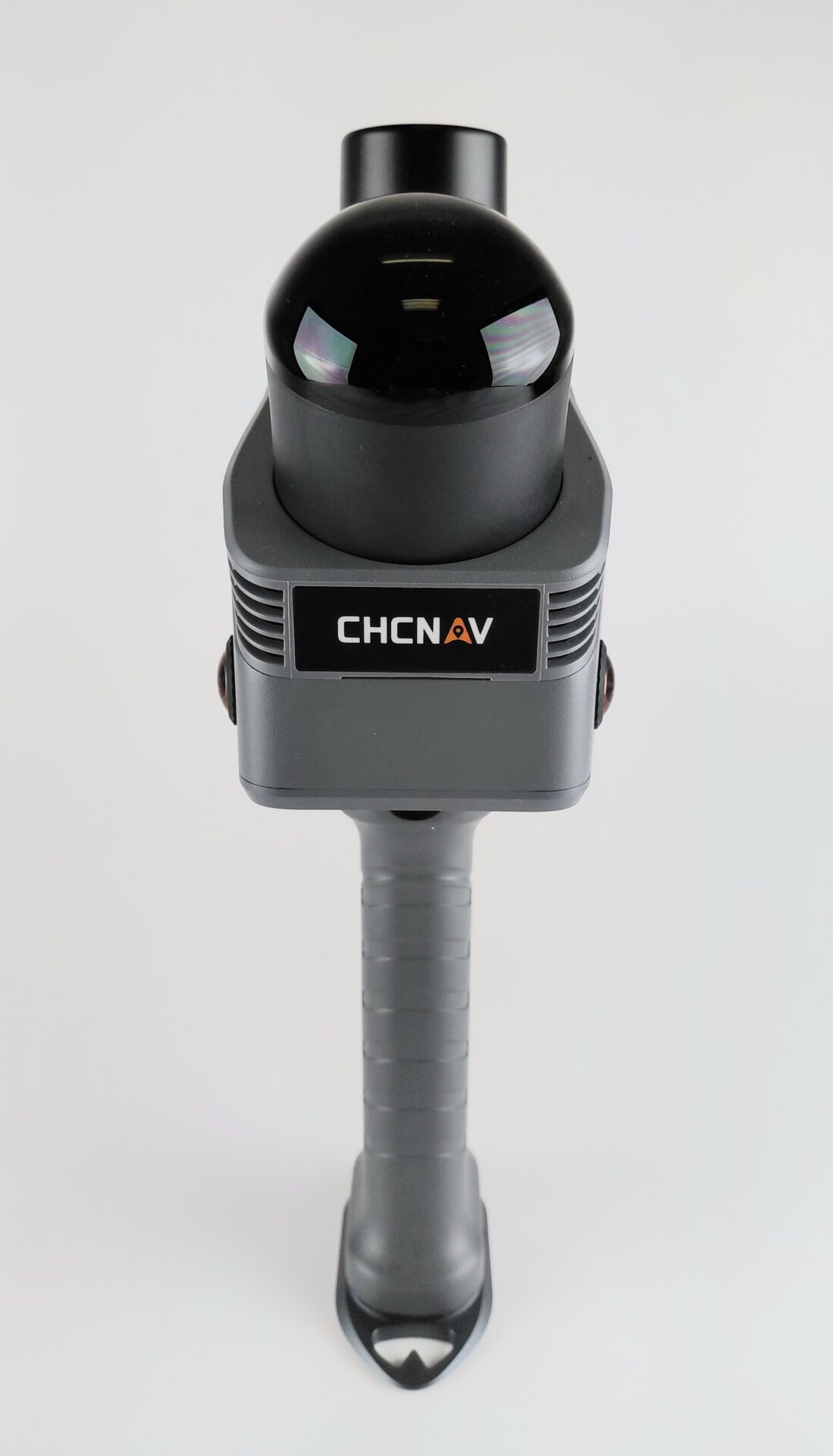
CHC Navigation’s RS7 is a high-performance, tool-grade, handheld LiDAR SLAM Scanner. It provides a low-cost scanning solution for indoor and short to medium-range outdoor 3D mapping.

In stock

Product price
Additional options total:
Order total:
0
Category:

Product Description

Walk the site. Leave with a georeferenced point cloud.

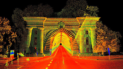
The CHCNAV RS7 is a handheld LiDAR SLAM scanner with RTK GNSS built in, and it’s the tool for the jobs where a rover can’t hold a fix and a tripod scanner would take all day: topo under canopy, stockpiles, building as-builts, and anything underground. You walk the site at a normal pace. The RS7 tracks its own position, builds a colorized point cloud as you go, and shows it live on your phone so you can see gaps before you leave.

Put it on your coordinates three ways: RTK corrections through your phone, control points checked and adjusted in CoPre, or a local system when the job doesn’t need more. Under the hood: up to 1.15 million points per second, a 360° × 189° field of view, a 0.5°/h IMU that holds the trajectory where SLAM usually drifts, dual HD cameras, and 3D Gaussian Splatting output. 1.2 kg in the hand.

· CoPre processing software included · Authorized CHCNAV dealer · On-site demos throughout Northern California

Request a quote · Book a demo · 1-800-866-8576


Where it fits

SLAM (Simultaneous Localization and Mapping) means the scanner solves its own position continuously from the geometry around it. No setups, no targets required, no GNSS required. Instead of occupying stations and registering scans afterward, you walk one continuous path and the registration happens as you go. Add the RS7’s onboard RTK and the cloud lands on your project coordinates without a separate tie-in.

That makes it the instrument for the work that falls between a GNSS rover and a terrestrial scanner:

  • Topo on sites where the canopy or the buildings kill your fix
  • Stockpile and pit volumes without walking a rover over every breakline
  • As-builts and interiors at a walking pace instead of a dozen setups
  • Tunnels, vaults, basements, and anything else with no sky

It is not a replacement for your rover or total station on boundary and control work. It’s the tool for everything else.

Three ways to put it on your coordinates

RTK. The RS7 has a multi-constellation GNSS receiver onboard (GPS L1/L2/L5, GLONASS, BeiDou, Galileo). Corrections come in over NTRIP through your phone’s data connection, using your existing network subscription. Absolute accuracy is under 3 cm RMS, horizontal and vertical, in open sky. Initialize outside and walk in; the SLAM trajectory carries your coordinates through the door.

Control points. Shoot or occupy control anywhere, inside or out, and check and adjust the cloud to it in CoPre. This is the workflow for tight tolerances, for sites with poor sky, and for anyone who wants check shots on the record.

Local coordinates. For interior-only work, skip georeferencing and work in a local system. Tie it in later if the job changes.

What the accuracy numbers mean

The datasheet gives three figures, and they answer different questions.

Figure Spec What it tells you
Relative accuracy under 1 cm point-to-point within the cloud (lab conditions)
Repeatability under 2 cm scan the same thing twice, get the same answer (lab conditions)
Absolute accuracy under 3 cm RMS, H and V where the cloud sits on your coordinate system via RTK (open sky)

In practice: right for topo, as-builts, volumes, interiors, and underground mapping. Not for boundary or control-level precision; that stays with your rover and total station.

Why it holds up where SLAM drifts

SLAM on its own struggles where there’s little distinctive geometry: a long blank corridor, a stairwell, a tunnel, a warehouse aisle, repetitive floor plates. The RS7 fuses its SLAM engine with a high-grade inertial system, gyro bias instability better than 0.5°/h at a 500 Hz update rate, so the trajectory holds through those stretches instead of wandering. Fewer failed loops, fewer re-walks, cleaner data on exactly the jobs that break lighter units.

Full coverage in one pass

A 64-channel LiDAR at up to 1.15 million points per second in dual-return mode (576,000 single return), 40 m range at 10% reflectivity, and a 360° horizontal by 189° vertical field of view. Floors, walls, ceilings, the pile and the ground around it, all in the cloud from one walk. No tilting the unit for ceilings or re-walking corners.

Color, imagery, and 3D Gaussian Splatting

Dual 12 MP cameras (48 MP sensors, pixel-binned for low light) colorize the cloud and hold up in dim interiors and vaults. CHCNAV’s HPGS 2.0 engine turns the same capture into a 3D Gaussian Splatting model: a photorealistic, navigable scene a client can read at a glance, alongside the measurable cloud.

Field to deliverable

  • SmartGo NEO (Android) runs the scanner over Wi-Fi: project setup, NTRIP connection, live point cloud, playback, and upload. Android phone or tablet required; there is no iOS version.
  • CoPre, included with a perpetual license, does the office work: trajectory processing, control-point adjustment and refinement, point cloud generation, and 3D modeling, with colorized point clouds, mesh models, and 3DGS as outputs. Export to standard point cloud formats [FORMATS: LAS/LAZ, E57, etc.] for Carlson, Civil 3D, or whatever you draft in.
  • CoProcess (optional) adds point cloud processing with built-in CAD tools for scan-to-CAD, sections, and terrain modeling.
  • CoCloud (optional) gives you one-click upload from the field and automatic processing to point clouds, meshes, and 3DGS, with project management for a team.

What surveyors are running it on

Here’s what the surveyors we know with an RS7 are actually using it for.

Topo under canopy and on obstructed sites. Walk the site with RTK, let SLAM hold position where the sky closes in, and hit control on the way out. Surfaces and contours from the cloud instead of a rover fight.

Stockpiles and volumes. Walk around and, where safe, over the pile. Build the surface and run volumes in CoProcess or the package you already use. Repeat next month and compare.

As-builts and building interiors. Every floor, wall, ceiling, and stair in one pass, colorized. Floor plans, sections, elevations, and scan-to-BIM from the cloud.

Underground, tunnels, and utility vaults. No sky, no problem. Tie in at the portal or to control inside, and the IMU carries you through the featureless stretches.

Why buy from Precision Geosystems

  • Authorized CHCNAV dealer. Warranty, support, and updates through the proper channel.
  • On-site demo anywhere in Northern California. See it on your site, on your kind of job, before you buy.
  • Training available. Setup, field workflow, control-point adjustment, and CoPre processing, priced separately so you only pay for what your crew needs.
  • Financing available.
  • Trade-ins welcome on your existing equipment.
  • Survey-equipment people. We sell and support survey gear every day, so the questions you have are ones we’ve heard before.

FAQ

Does the RS7 have RTK? Yes, on every unit. The GNSS receiver is built in, and corrections come in over NTRIP through your phone’s data connection. Open-sky absolute accuracy is under 3 cm RMS.

Can I tie it to survey control? Yes. Shoot or occupy control points or targets, indoors or out, and check and adjust the cloud to them in CoPre. Most interior-only jobs run in local coordinates and skip this step.

How accurate is it? Under 1 cm relative, under 2 cm repeatability, under 3 cm RMS absolute with RTK. Field results depend on loop closure, walking speed, sky, and environment. Right for topo, as-builts, volumes, interiors, and underground; not for boundary or control.

What do I need to run it? An Android phone or tablet with SmartGo NEO, a network correction subscription if you want RTK, and a PC for CoPre. There is no iOS app.

Do I need CoCloud? No. CoPre is included and handles processing. CoCloud is optional for automated cloud processing and team project management.

How long does a battery last? About 150 minutes per handle under standard test conditions. The battery is built into the handle. [KIT: how many handles ship with it]

What does it cost? $9,945 for the standard kit. Financing available, trade-ins welcome, and we’ll quote CoProcess, CoCloud, extra batteries, and training as options.

Get a quote or book a demo

Call 800-866-8576, On-site demos throughout Northern California.

Software Options:

SmartGo Neo

SmartGo Neo is a free Android application designed by CHC Navigation to operate their handheld LiDAR SLAM scanners. You can download and install the app from the Google Play Store to control your equipment.

 Features and Usage

  • Real-time Preview: View live point cloud data during scanning to check coverage and catch gaps before leaving the site.
  • Device Control: Start and stop scans, check battery and storage levels, and run sensor diagnostics.
  • GNSS/RTK Settings: Configure GPS or correction data services for absolute coordinate mapping.
  • Project Management: Create new projects, select indoor or outdoor modes, and manage collected files.

CoPre

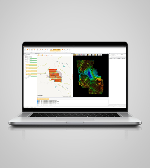
This hand scanner package includes a perpetual license of the CoPre software. CoPre is a comprehensive LiDAR processing software developed by CHCNAV for efficient and accurate mobile geospatial data processing. It offers a range of functionalities, including trajectory processing, point cloud and image georeferencing, colorization, filtering, and Digital Ortho Model (DOM) generation. CoPre supports all CHCNAV LiDAR systems and enhances the quality and accuracy of post-processing tasks, making it an indispensable tool for geospatial professionals. Features include:

  • Static, fast static, PPK, and PPP GNSS processing.
  • Customizable interface for seamless workflow.
  • Point cloud, image georeferencing, colorization, and result output.
  • DOM generation and 3D model export.
  • Process trajectory files, LiDAR data, and RGB images efficiently. CoPre uses a proprietary algorithm for accurate and efficient trajectory generation, supporting multiple data sets simultaneously to increase workflow efficiency.


Additional software options for data extraction and CAD processing are available through CHCNAV, although some of these same functionalities can be provided by other programs, such as Carlson Point Cloud Advanced. The CHCNAV options are described below:

CoProcess

CoProcess is a professional point cloud processing software designed to convert large-scale LiDAR datasets into engineering-ready deliverables. It integrates scan-to-CAD drafting, classification, terrain modeling, and volume calculation within a streamline AI-based workflows. Supporting datasets of over 300 GB, CoProcess enables efficient data processing, reduces manual operations, and accelerates the delivery of accurate survey outputs.

  • Generate 2D and 3D CAD drawings from point clouds with efficient drafting tools.
  • Automate point cloud classification and editing for structured data preparation.
  • Create DEM, DSM, contours for surveying workflows.
  • Perform stockpile and earthwork volume calculations, and analyze volume changes over time.
  • Built for large-scale point cloud processing, CoProcess handles datasets exceeding 300 GB in a single workflow. It supports stable rendering and efficient processing of billions of points, allowing users to work with full-resolution data and preserve detail across large survey projects.

System

  • Operating system : Microsoft Windows 10,11(64-bit)
  • Languages : English, Russian, German, French, Spanish, Japanese, Korean, Chinese

Features

  • Functions : Point Cloud Processing Software for Scan-to-CAD and Terrain Modeling
  • File formats : LAS, LAZ, E57, HPCX, HPC, CODATA, PTX, ASC, TXT, CSV, DAT, XYZ, OSGB, DWG, DXF, TIF, TIFF, JPG, JPEG, BMP, PNG,
  • Modules : Base, Vector, Classification, Terrian, Volume

Call us for current pricing and details.

CoCloud

CoCloud is a cloud-based 3D platform for processing, storing, and managing multi-source data. It delivers high-quality DOMs, point clouds, and OSGB models without requiring local hardware. With built-in tools and real-time collaboration features, CoCloud simplifies workflows and enhances teamwork across 3D tasks such as data rendering, volume calculations, point cloud editing, and more. Features include:

  • End-to-end platform for 3D data processing, management and visualization.
  • Rich and intuitive features for a wide variety of scenarios.
  • Advanced photogrammetry engine for high precision and clarity.
  • Flexible API and private deployment to meet specific project requirements.
  • Affordable and fast, CoCloud enables professional-grade LiDAR and imagery processing online delivering high accuracy and results without the need for costly hardware or complex installation.
  • Tailored for surveying professionals, the intuitive platform replaces traditional desktop tools with one-click functionality. No specialized training is required for effective operation.
  • Leveraging data across hundreds of thousands of square kilometers, CoCloud’s advanced photogrammetry engine generates precise orthophotos and detailed oblique models, ensuring consistent accuracy across a wide range of applications.
  • Built for digital integration, CoCloud provides flexible API access and private deployment options, supporting full workflow integration from data collection to application within client systems.

Call us for current pricing and details.


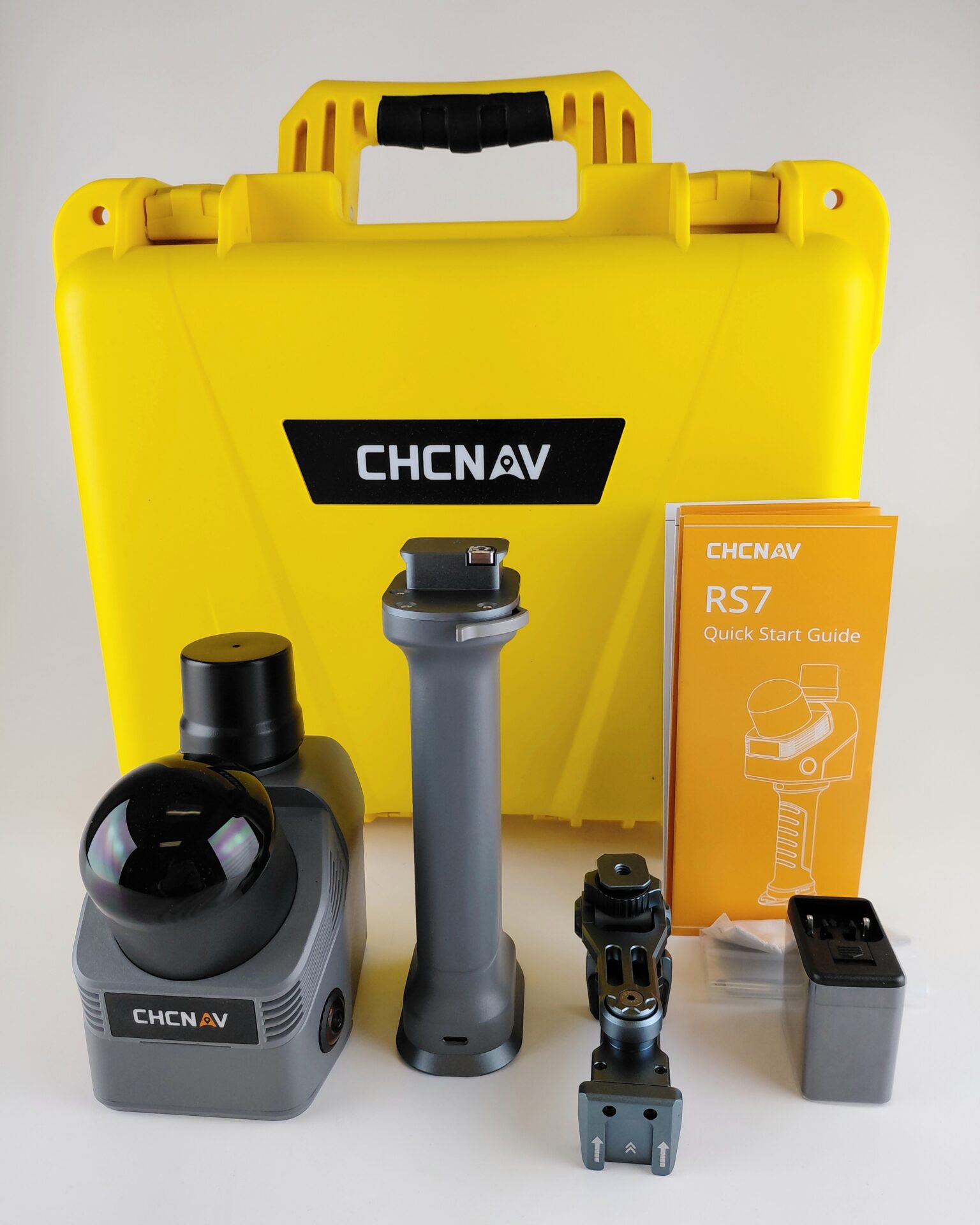
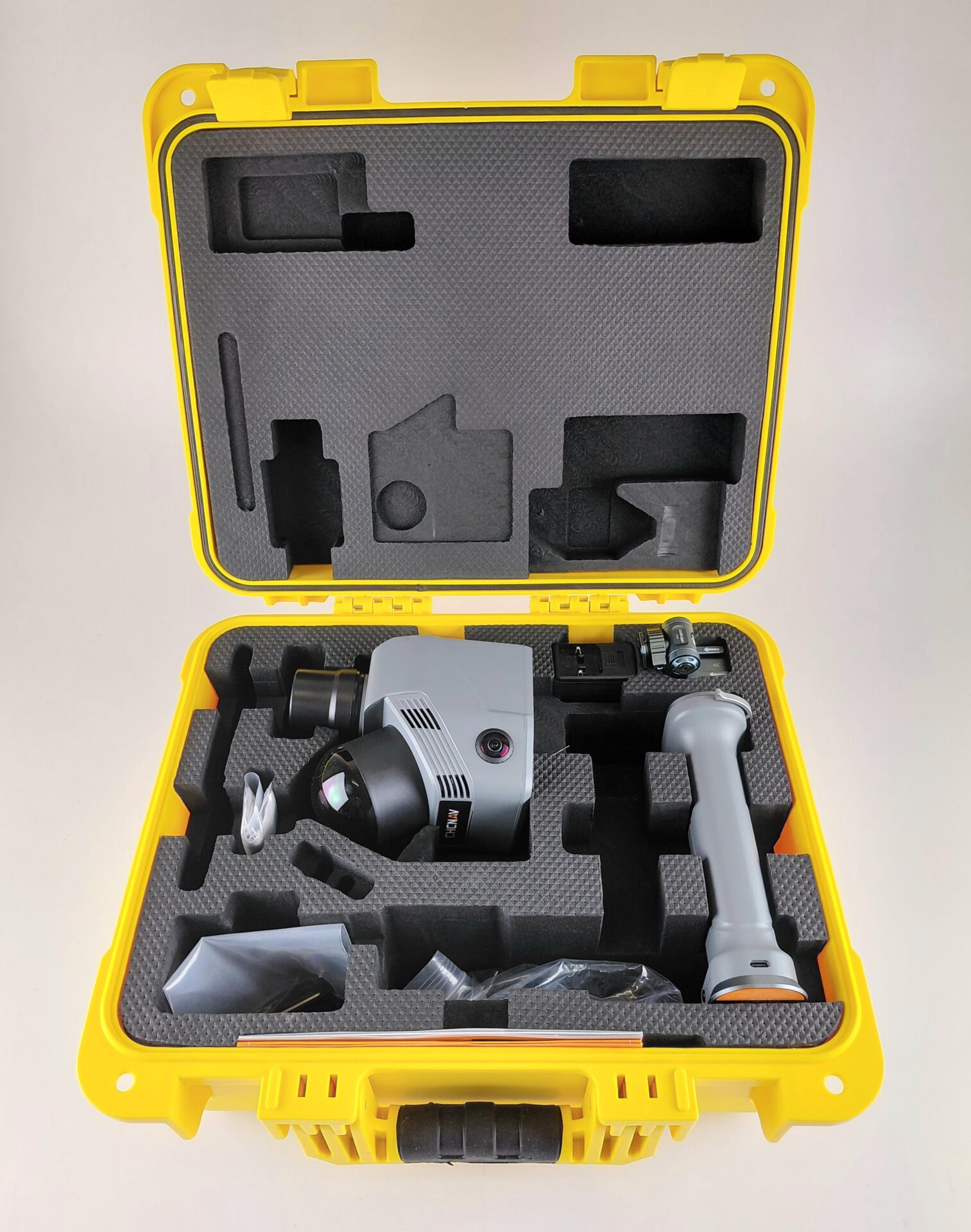
This kit includes:

  • RS7 SLAM Scanner
  • 47.5 Wh Battery
  • Pole mount for phone controller
  • Cable for charging and data transfer
  • Quick Start Guide
  • Hard Case


SPECIFICATIONS

General System Performance

Absolute accuracy: H: < 3 cm RMS (1) | V: < 3 cm RMS (1) Relative accuracy: <1 cm (2) Repeatability: <2 cm (2) Power supply mode: Battery integrated in handle Battery capacity: 47.5 Wh Working time from a single battery: 150 mins (3) Power consumption: 16 W Data storage: 512 GB Weight(with Battery Handle): 1200 g Operating temperature: -20 °C to +50 °C Ingress protection: IP64 (4) (according to IEC 60529)

Laser Scanner

Laser product classification: Class 1 Eye Safe
Range: 40 m @10% Reflectivity
Channel: 64
Max. effective measurement rate: Single Return: 576,000 pts/sec | Dual Return: 1,152,000 pts/sec
Field of view: 360° × 189°
Wavelength: 905 nm

Positioning and orientation system

GNSS system: GPS: L1,L2,L5 | GLONASS: L1,L2 | BEIDOU: B1,B2,B3 | GALILEO: E1,E5a,E5b
IMU update rate: 500 Hz
Gyro zero bias instability: 0.5°/hr
Gyro random walk: 0.01°/√hr
Acc zero bias instability: 10 ug
Acc random walk: 0.017 m/s/√hr

Camera

Number of cameras: 2
Resolution: 48 MP
Sensor size: 1/2 inch
FOV: 340°(H) × 360°(V)

Communication

Wi-Fi: 2.4GHz & 5GHz | IEEE 802.11n/ac (U-NII-1/3)
Bluetooth: V5.3 (BR+EDR+BLE)
Ports: 1 x USB V3.0 Type-C port (data download) | 1/4″ mounting thread

Optional Software

SmartGo software: Data acquisition control, Real-time point cloud display, etc.
CoPre intelligent processing software: POS Processing, Adjustment & Refinement, Point Cloud Generation, 3D Modeling. Supports Colorized Point Clouds, 3D Mesh Models, and 3D Gaussian Splatting (3DGS) Outputs.
CoProcess 2025: point cloud processing with built-in CAD tools

Footnotes

*All specifications are subject to change without notice.

(1) According to CHCNAV test condition.Accuracy and reliability are determined under open sky, free of multipaths, optimal GNSS geometry and atmospheric condition. Performances assume minimum of 5 satellites, follow up of recommended general GPS practices.
(2) Measured under laboratory conditions; actual performance may vary.
(3) Tested and obtained in a standard laboratory environment at 25°C.
(4) Splash, water, and dust resistant and were tested under controlled laboratory conditions with a rating of IP64 under IEC standard 60529.