Your Dealer for Carlson Surveying Equipment!
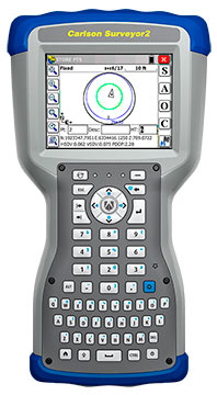
 While in recent years other companies have excelled in the area of field equipment hardware development, Carlson has long had the market advantage in the areas of surveying software and data collectors. From its early beginnings with simple coordinate geometry routines, the company has led the industry in the development of data collection software that would run on a variety of devices. Their flagship Carlson data collector, the Surveyor2, has been on the market for many years and now carries an impeccable reputation for ease of use, durable build-quality, unsurpassed data management, and affordable price.
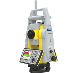
When Carlson recently decided to enter the broader survey field-equipment market, it was only natural that they should partner up with GeoMax, the company that was producing some of the finest and most affordable electronic survey instruments available. The combination of a Carlson robot, Carlson GPS system, Carlson data collector, and Carlson SurvCE data collection software offers unparalleled and seamless integration throughout the system. The tech support provided by Carlson far surpasses the industry standard; it is free and highly responsive to calls from users. And perhaps most importantly, a Carlson robotic total station comes with a copy of Carlson SurvCE data collection software installed on-board the instrument. This contributes significantly to the overall value of the system without adding anything to the cost. We highly recommend this type of integrated system.
Carlson Robotic Total Stations, are a Carlson Software branded version of the popular GeoMax Robotic Total Stations. The units are identical to the GeoMax products, offering superior performance and exceptional value.
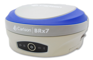
Carlson GPS Systems offer some of the best value on the market for Global Positioning equipment. Surveyors, engineers, and construction professionals rely on the quick and efficient signal acquisition, high accuracy, and ease of use that Carlson GPS systems provide. These units work seamlessly with the industry-standard data collection software that has made the Carlson name recognized throughout the world.
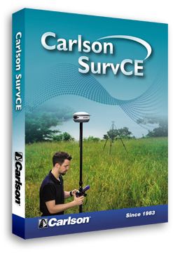
Carlson Data Collectors are some of the most widely used in the industry. The Surveyor2 runs with the now famous SurveCE data collection software. The Carlson Mini2 is a small lightweight data collector that packs the power of many much larger devices.
Precision Geosystems carries the complete line of Carlson software products. These include:
- SurvCE, the first choice in data collection software, with options for total station, robotics, GPS, and advanced roading.
- SurvPC, provides all of the above options, but runs on the Windows operating system for use on many different hardware platforms.
- Carlson Field, that enables real-time surveying in CAD on small, ruggedized PC/laptop computers.
- Carlson CSI Mobile, designed by and for Law Enforcement Professionals, is easy-to-learn-and-use crash/crime scene software that utilizes the top data collection technology of Carlson Software, which has been adapted by police professionals for law enforcement’s specific needs. This software is available in both standard and GPS enabled options.
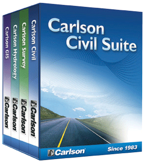
- Carlson Civil Suite: The Ultimate Civil Package. Get Fair Price, Full CAD, and Free Support with Carlson Software’s Civil Suite, a powerful bundle made up of: Carlson Survey (see above), Carlson Civil, Carlson Hydrology, and Carlson GIS. These four civil-related modular programs, working together, provide the ultimate civil package that dramatically increases productivity while helping users create better designs. All Carlson office software modules come with perpetual and maintenance licensing with Carlson customers allowed to own the software and to upgrade when they choose.
- Carlson Survey, which provides a full tool kit, everything from network least squares to surface modeling, that works seamlessly between office and field. Contains all the basic routines needed for land surveying.
- Carlson Takeoff Suite, is a cut/fill volumes and data prep (for layout or machine control) solution that can estimate jobs using paper plan digitizing, PDFs, or electronic CAD files.
- Carlson Point Cloud, a modular program that provides the ability to go from field scan to finished plat, Carlson Point Cloud delivers powerful automation for large data sets—view and process up to 1 billion points all with Carlson ease-of-use.
- Carlson SurveyGNSS, designed for surveyors and positioning professionals, Carlson SurveyGNSS is a simple, yet powerful post-processing software that achieves high accuracy results for computing quality vectors and resultant positions.
- Simplicity Sight Survey is a Windows-based coordinate geometry program. Simplicity provides simplified methods for solving commonly encountered coordinate geometry and construction surveying problems.
Our Featured Carlson Products (Click for More Details)
Shipping